In partnership with NOAA, Saildrone Inc. is deploying seven ocean drones to collect data from hurricanes during the 2022 hurricane season. The goal? To improve hurricane forecasting. Learn more: NOAAResearch
In partnership with NOAA, Saildrone Inc. is deploying seven ocean drones to collect data from hurricanes during the 2022 hurricane season with the goal of improving hurricane forecasting. For the first year, two saildrones will track hurricanes in the Gulf of Mexico.
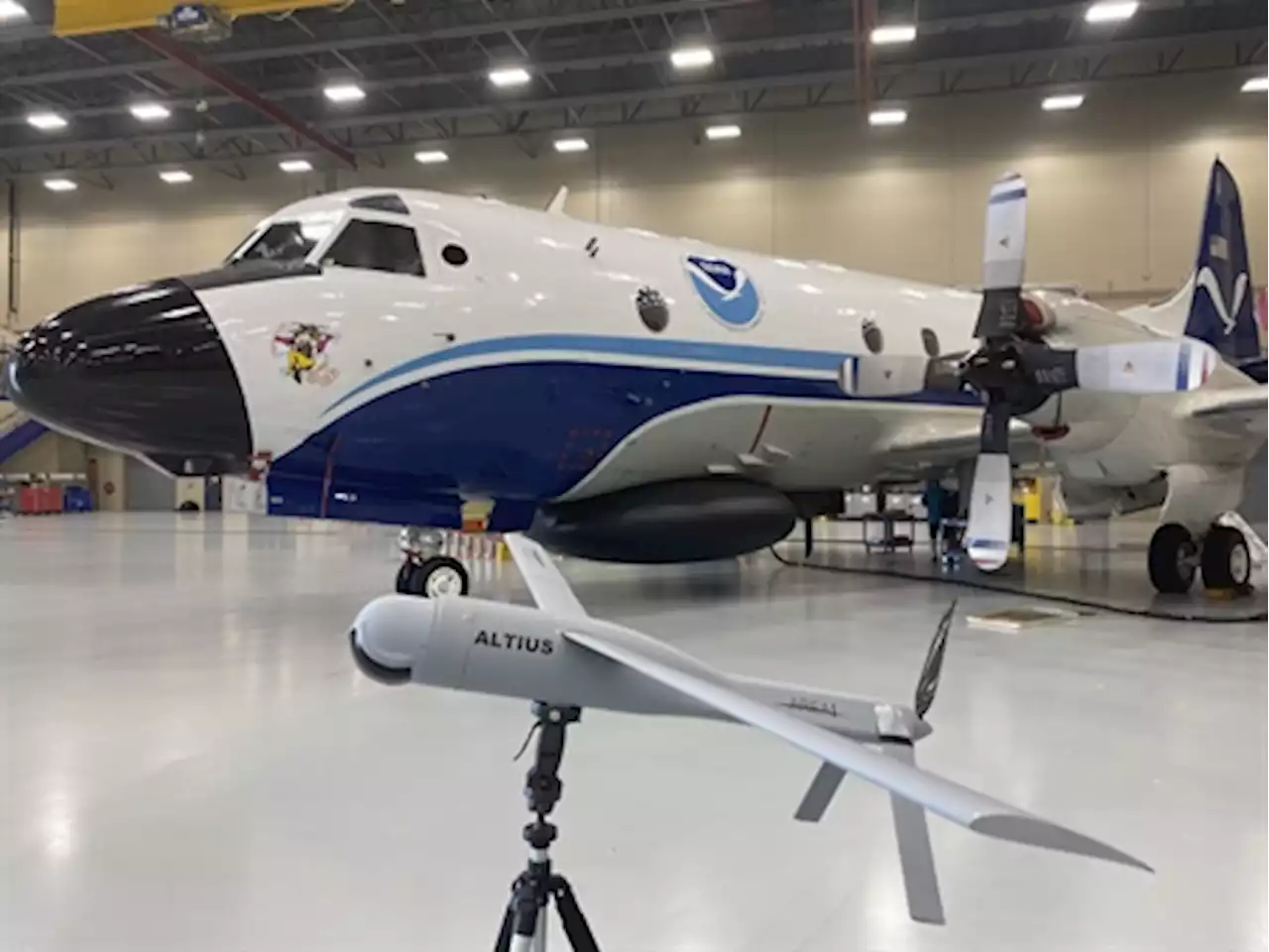
One of the biggest challenges to hurricane forecasting is predicting rapid intensification, when hurricane wind speeds increase at least 35 mph over a 24 hour period. To fully understand how storms intensify, scientists collect data on the exchange of energy between the ocean and atmosphere in the forms of heat and momentum. However, gathering data in this dangerous environment is best accomplished by uncrewed systems.
. “Storms that intensify rapidly can cause extensive damage and loss of life and real-time observing systems are crucial to better understanding the atmospheric and oceanic processes that lead to the formation and intensification of these hurricanes.” The Altius uncrewed drone is pictured with NOAA WP-3D Orion Hurricane Hunter Aircraft in the background at NOAA Aircraft Operations Center in Lakeland, Florida, on May 25, 2022.
Österreich Neuesten Nachrichten, Österreich Schlagzeilen
Similar News:Sie können auch ähnliche Nachrichten wie diese lesen, die wir aus anderen Nachrichtenquellen gesammelt haben.
 NOAA kicks off virtual summer film festivalNOAA is pleased to announce the kickoff of its inaugural virtual summer film festival! Find out details about the festival: And enjoy our 1st featured video, NOAA in the Central Region: NOAANationwide
Weiterlesen »
 Largest California wildfire seen on NOAA space satelliteNational Oceanic and Atmospheric Administration (NOAA) geostationary satellites have captured the impact of California’s largest wildfire.
Weiterlesen »
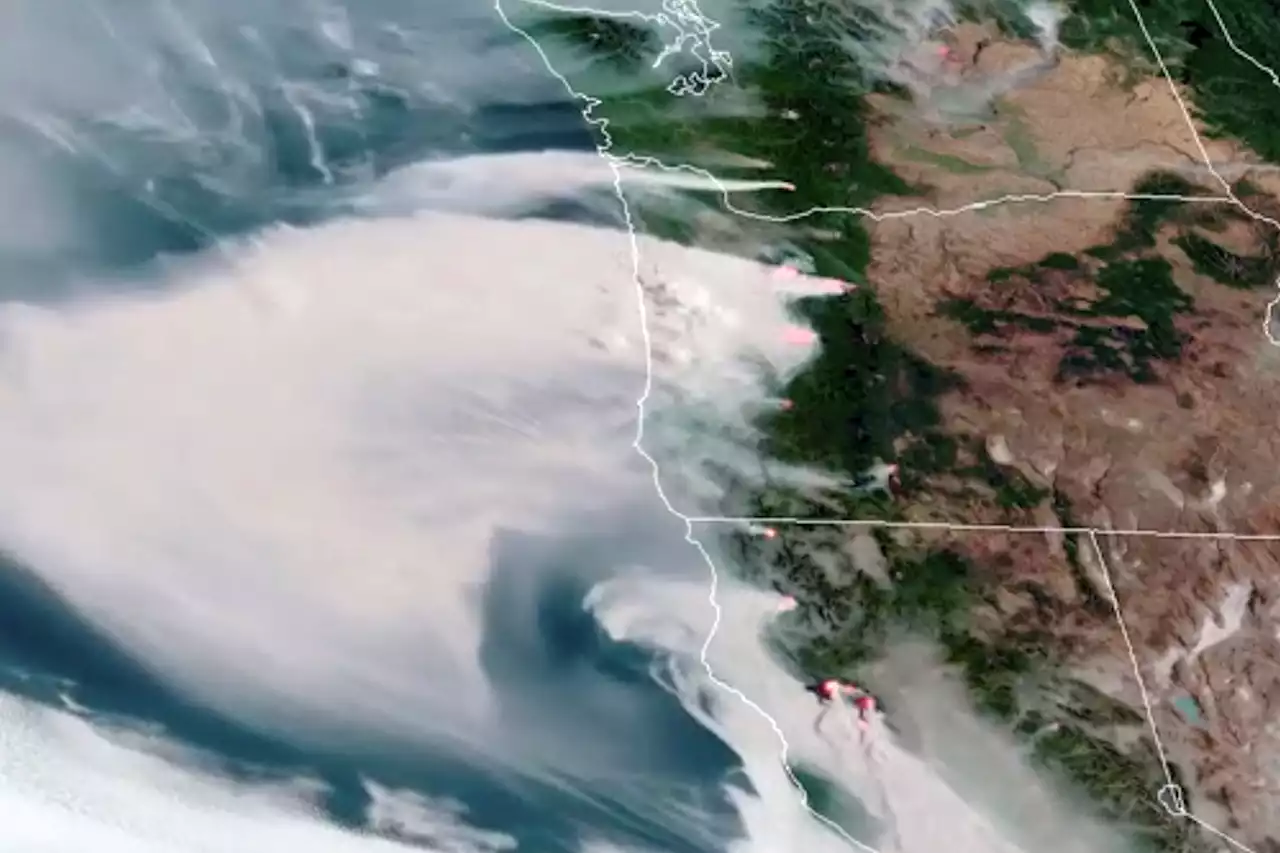
 Largest California wildfire seen from NOAA space satelliteSmoke plumes from the largest wildfire burning in California are seen in NOAA space satellite images. The McKinney Fire has scorched more than 55,000 acres so far.
Weiterlesen »
With lunar orbiter, South Korea will join a revived race to explore the MoonIf all goes well next week, South Korea will join the small number of countries to have sent spacecraft to the Moon—and scientists around the world are looking forward to the results.
Weiterlesen »
Largest California wildfire seen on NOAA space satelliteNational Oceanic and Atmospheric Administration (NOAA) geostationary satellites have captured the impact of California’s largest wildfire.
Weiterlesen »
Largest California wildfire seen from NOAA space satelliteSmoke plumes from the largest wildfire burning in California are seen in NOAA space satellite images. The McKinney Fire has scorched more than 55,000 acres so far.
Weiterlesen »